


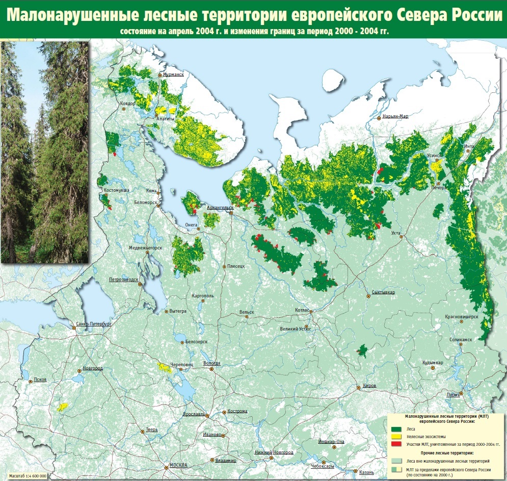
- Fig. 1. Map of intact forest areas of the European North of Russia (as published in 2004)
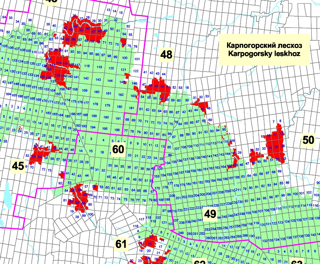
- Fig. 2. Fragment of the map of intact forest areas of the Arkhangelsk region (a site in the interfluve of the Northern Dvina and the Pinega with an indication of the boundaries of forestry enterprises and forestries and the numbering of forest quarters within the boundaries of intact forest areas)
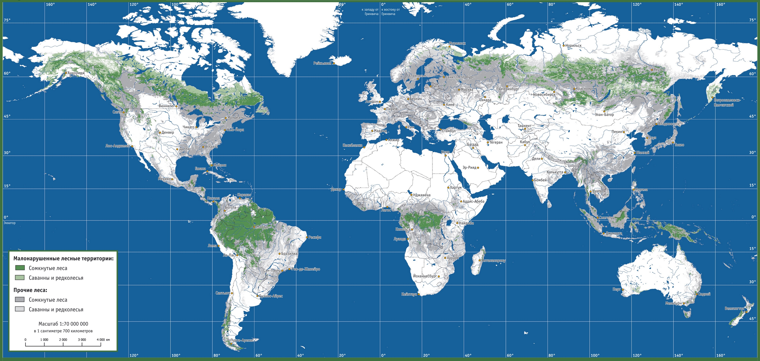
- Fig. 3. Map of intact forest areas of the world as of 2004 (as published in 2006)
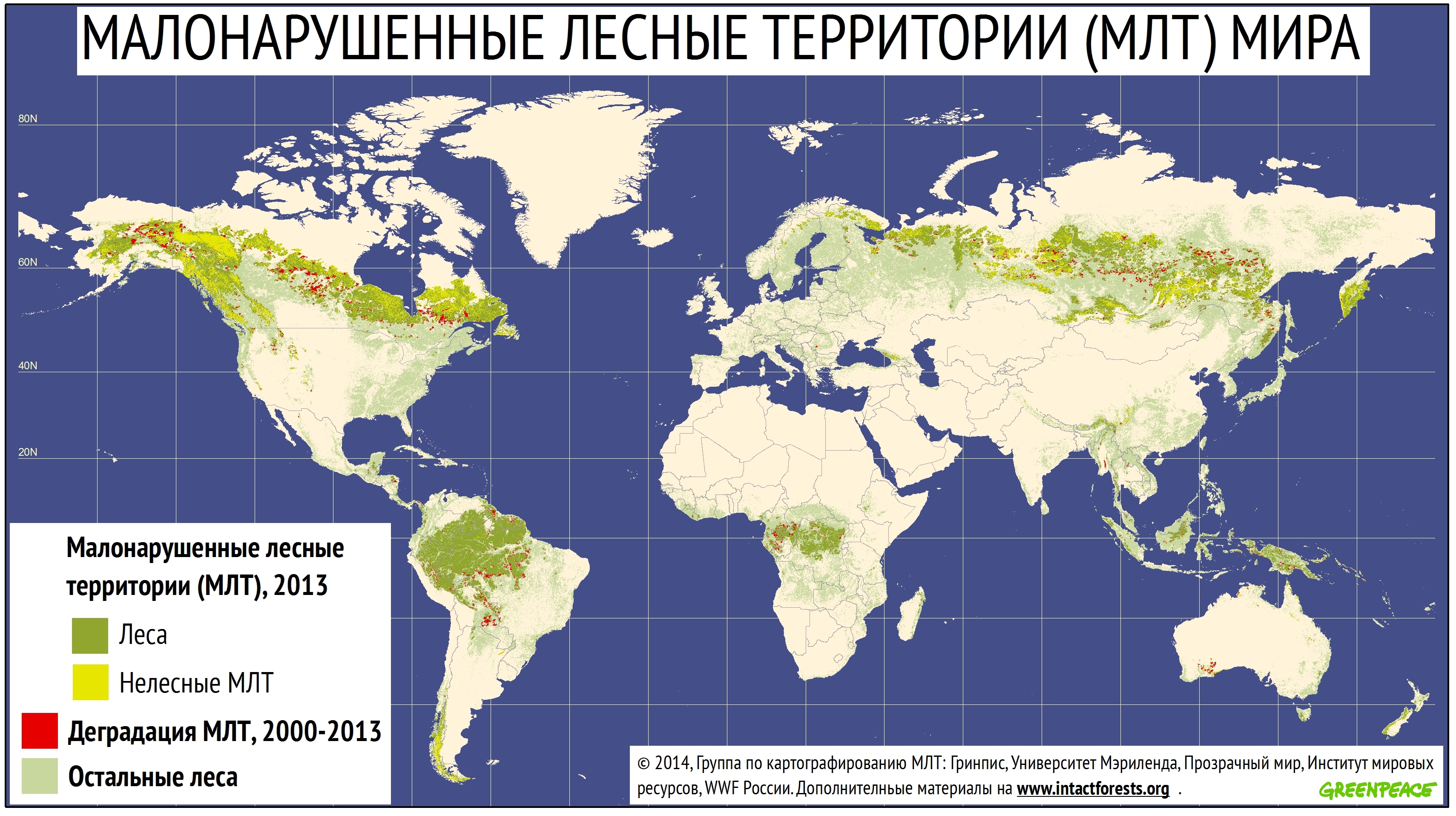
- Fig. 4. Map of intact forest areas of the world as of 2014 (as published in 2014)
Copyright © 2016 RJEE. THE ONLINE EDITION IS REGISTERED IN THE FEDERAL SERVICE FOR SUPERVISION OF COMMUNICATIONS, INFORMATION TECHNOLOGY, AND MASS MEDIA. REGISTRATION CERTIFICATE № FS 77 – 62950 from 04.09.2015.