


- Fig. 1. Floodplain islands of the Kazan region of variable backwater at normal water level and locations of soil slits
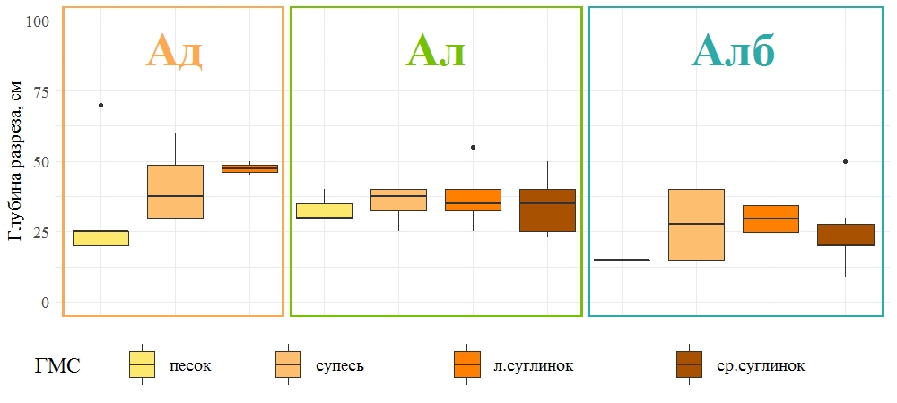
- Fig. 2. The depth of soil profiles of alluvial soil with different textures
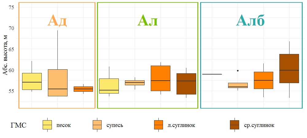
- Fig. 3. Elevation distribution of alluvial soils with different texture
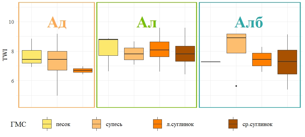
- Fig. 4. Topographic wetness index distribution of alluvial soils with different texture
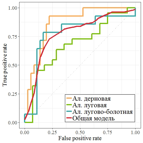
- Fig. 5. ROC curves of logistic regression models
Copyright © 2016 RJEE. THE ONLINE EDITION IS REGISTERED IN THE FEDERAL SERVICE FOR SUPERVISION OF COMMUNICATIONS, INFORMATION TECHNOLOGY, AND MASS MEDIA. REGISTRATION CERTIFICATE № FS 77 – 62950 from 04.09.2015.