


- Fig. 1. Floodplain islands of the Kazan region of variable backwater at normal water level and locations of soil slits
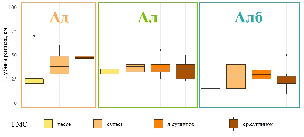
- Fig. 2. The depth of soil profiles of alluvial soil with different textures
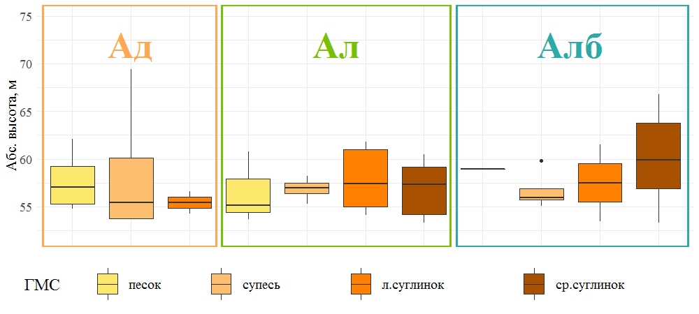
- Fig. 3. Elevation distribution of alluvial soils with different texture
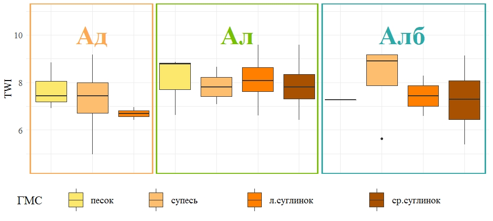
- Fig. 4. Topographic wetness index distribution of alluvial soils with different texture
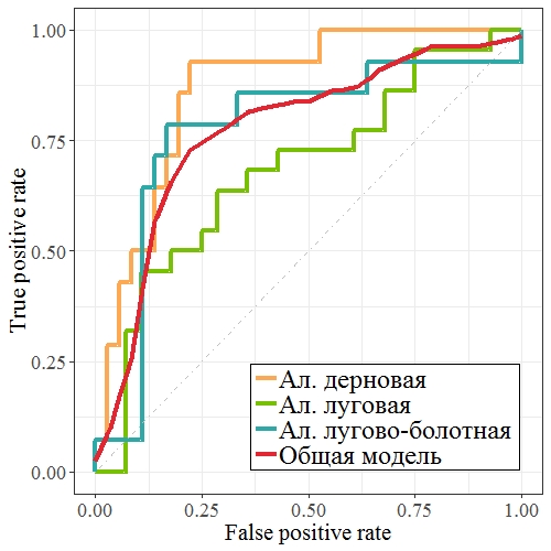
- Fig. 5. ROC curves of logistic regression models
Copyright © 2016 RJEE. Сетевое издание зарегистрировано в Федеральной службе по надзору в сфере связи, информационных технологий и массовых коммуникаций. Свидетельство о регистрации Эл № ФС 77 - 62950 от 04 сентября 2015 г.